Voyage Planning
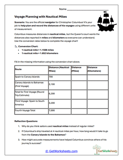
This worksheet is designed for students in Grades 5 and 6 to strengthen math skills, geographic understanding, and historical thinking through a navigation-themed activity based on early exploration. Learners act as Christopher Columbus’s navigator by using a provided conversion chart to calculate distances between voyage locations in nautical miles, miles, and kilometers, applying mathematical reasoning within a meaningful historical context.
Skills Reinforced
- Unit Conversion (Grades 5-6) – Students convert measurements between nautical miles, miles, and kilometers using a reference chart.
- Applied Math Reasoning – Learners practice accuracy and problem-solving while filling in a structured data table.
- Exploration & Navigation Concepts – Builds understanding of how distance measurement supported early sea travel.
- Geographic Thinking – Reinforces awareness of routes, distances, and spatial relationships.
Instructional Benefits
- Teacher-Created Resource – Designed by educators to integrate math with social studies content.
- Real-World Historical Context – Connects abstract math skills to authentic navigation challenges.
- Reflection Questions Included – Prompts students to think about why nautical miles are used at sea and the importance of measurement accuracy.
- Low-Prep & Printable – Easy to use for math lessons, interdisciplinary units, or homeschool instruction.
This printable worksheet helps students apply unit conversion skills in a purposeful, engaging way while learning about early exploration and navigation. By calculating voyage distances and reflecting on measurement systems, learners strengthen mathematical fluency, critical thinking, and geographic understanding. Ideal for classroom or homeschool use, this activity offers a meaningful crossover between math, history, and real-world problem solving.
This worksheet is part of our Columbus Day Worksheets collection.
Bookmark Us Now!
New, high-quality worksheets are added every week! Do not miss out!